
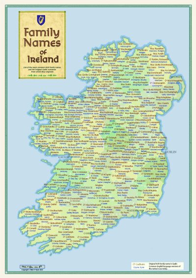
Description
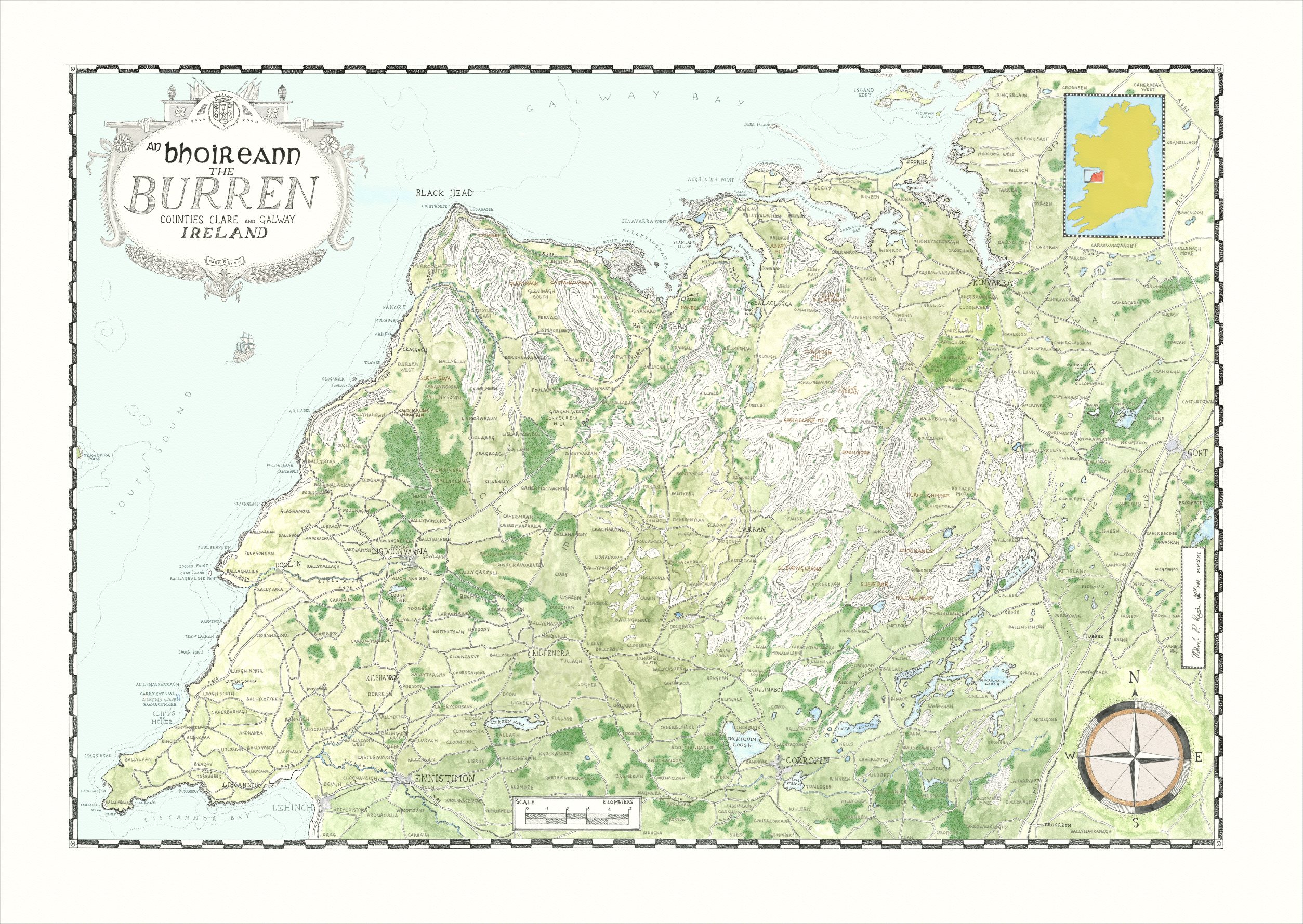
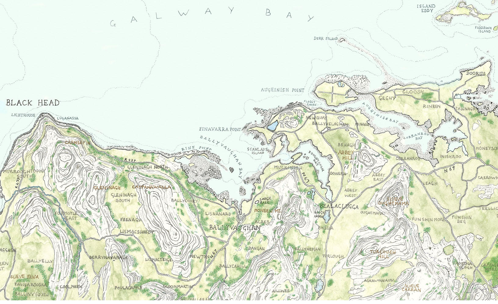
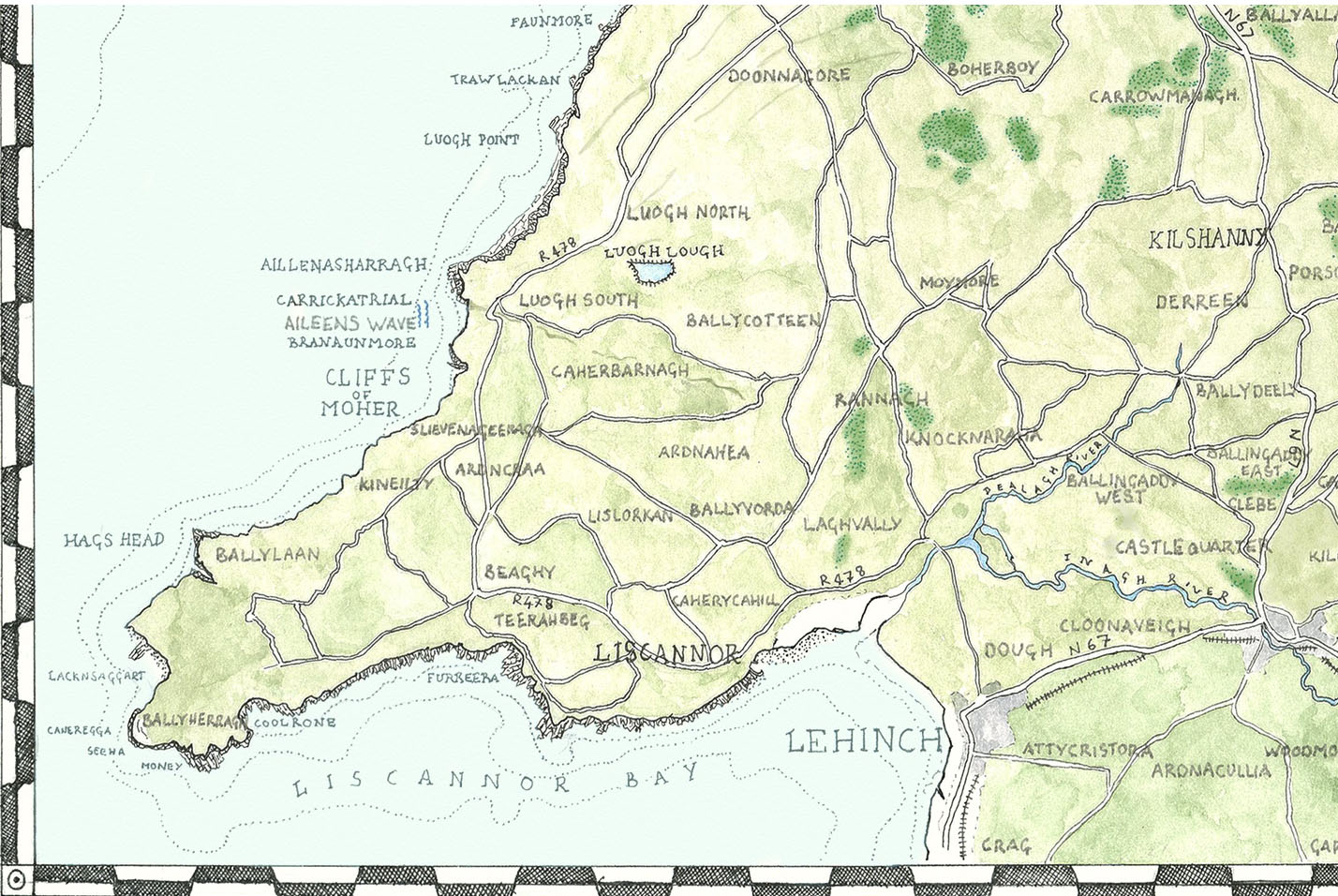
An illustrated map of the Burren in county Clare in Ireland. This map uses older Cartographic techniques coupled with illustration to show the beautiful karst limestone landscape of this unique area. Vibrant colours are used to distinguish the land types. The map covers the whole area from Lahinch to Gort to Kinvara.
The map is printed on 280gsm paper with Archival inks. Available Now!
This item is unframed-ships in a sturdy 100% recyclable postal tube by Premium tracked post
Returns policy; If you are in any way unhappy with your purchase you may return it for a full refund.
Reviews
There are no reviews yet.